About
Site Directory
Copyright © www.isleofman.com
All Right Reserved
powered by ![]()
Copyright © www.isleofman.com
All Right Reserved
powered by ![]()
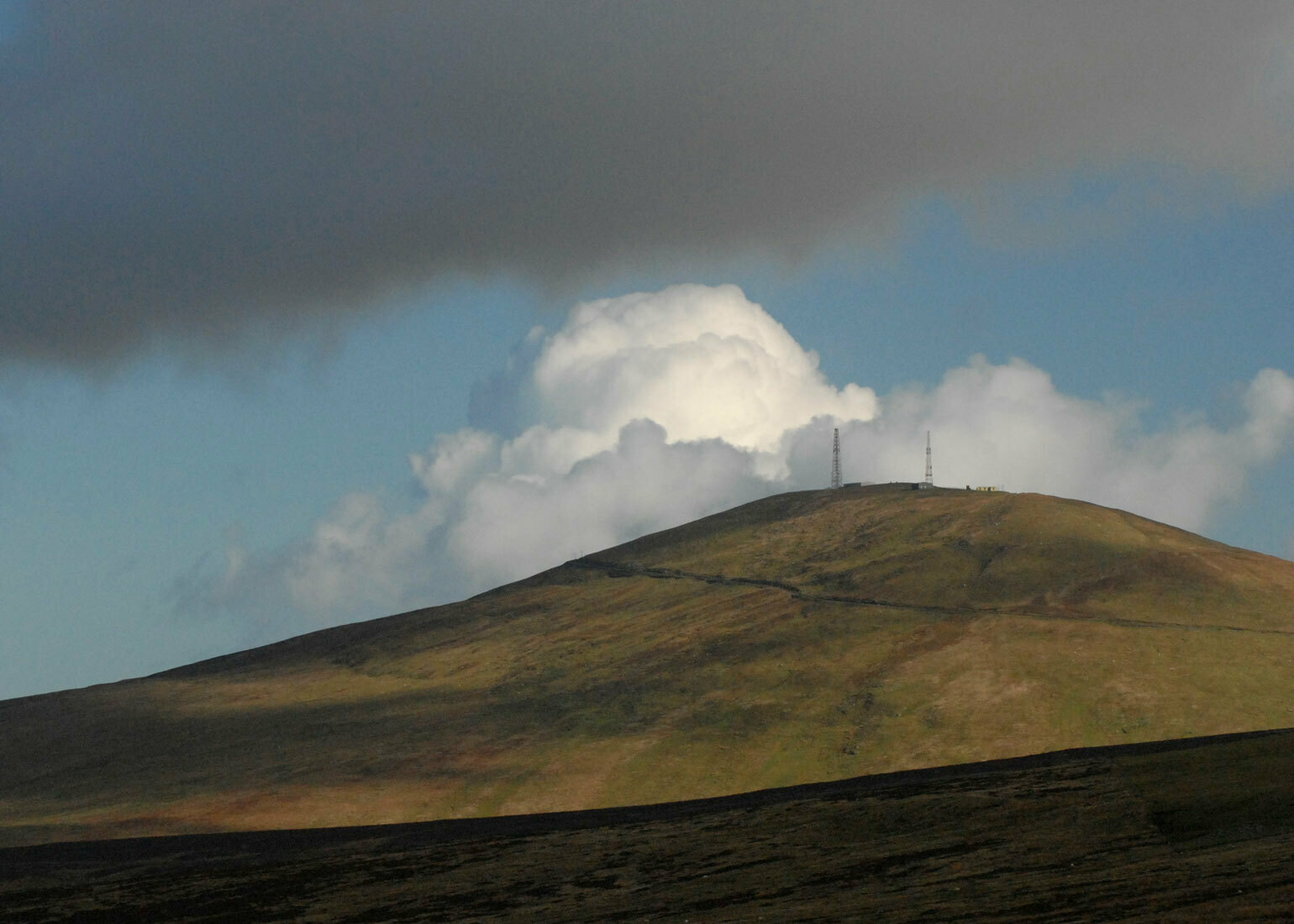
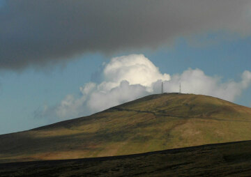
Snaefell is the only mountain in the Isle of Man, standing at 2036 feet
Located in the north of the island, Snaefell is the Island's only mountain, standing at 2036 feet (621 metres) above sea level.
The easiest access is by car, via the Mountain Road (A18) at the 'Bungalow' (about 1360 ft above sea level), which is the highest point of the 'mountain' section of the Isle of Man TT course.
Hill-walkers can tackle Snaefell as part of a longer walk from numerous starting points - plan your route with a map or local guide. Alternatively, take the Isle of Man Electric Railway to Laxey and transfer to the Snaefell Mountain Railway: you can alight at the Bungalow or take the tram all the way to the summit.
Height above sea level: 2036ft (621m)
OS Grid Reference: SC397881
It is a steady, moderate ascent from the Bungalow to the summit of Snaefell, which can be accomplished in a time of 15-30 minutes, depending on the fitness of the walker. It is easy, mostly grassy, walking terrain but marshy in places, particularly after rainfall, so it is advisable to wear sturdy, waterproof footwear.
The summit is distinguished by the terminus of the Snaefell Mountain Railway, a café and several communications masts.
There are impressively wide-ranging views over the Island and across the Irish Sea to the coastlines of neighbouring countries. In fact, there is a well-worn local saying that from Snaefell, on a clear day, one can see seven kingdoms: Mann, Scotland, Ireland, Wales, England, and rather more fancifully, Neptune and Heaven.
To the east of the Island, a long stretch of the western Scottish coastline can be seen, from the Mull of Galloway and past the mountain range of Criffel to the Solway Firth. The Cumbrian mountains are also visible, including Scafell Pike, the highest peak in England. Looking to Wales, you may see Snowdon, the Creuddyn Peninsula and the Isle of Anglesey. To the west, a significant section of the Irish coastline can be seen, from Strangford Lough to the Mourne Mountain range.
As regards the Island itself, a great deal of it is visible from the summit, apart from those areas obscured by the slopes of Snaefell itself and the hill ranges surrounding it. The views over the Sulby Valley, immediately to the west of Snaefell, and the ridge of North Barrule, to the north-east, are particularly rewarding.
A descent may be made from Snaefell in various directions, leading on to excellent hill walks. After crossing the Mountain Road at the Bungalow, it is possible to walk directly down into Laxey through the Agneash Valley, taking in the Snaefell Mines, Agneash Village and the Laxey Wheel on the way.
The peak immediately to the south of Snaefell, Bhein-y-Phott (pronounced 'Penny Pot') is a good point from which to either head west, to Brandywell, Druidale and the slopes above Kirk Michael - Slieau Freoghane and Slieau Dhoo - or south to the adjacent summit of Carraghyn, which gives excellent views over the East and West Baldwin Valleys, and Injebreck Reservoir. West Baldwin in particular offers scope for several more onward routes.
In a northwest direction lies the Sulby Valley, whose upper slopes have a number of interesting tholtans (deserted Manx farmsteads) and highly scenic walks. From Sulby Village it is a short journey by bus north to Ramsey or down the coast to Ballaugh, Kirk Michael and Peel.
By going directly northwards, it is possible to join the Millenium Way, the 28-mile footpath stretching from North to South. Follow it to Sky Hill - site of a decisive victory by King Orry over the Manx in 1079 - or explore the valleys of Narradale and Glen Auldyn.
To explore the north-east coast of the Island, an excellent starting point is to descend Snaefell to meet the point on the Mountain Road known as 'Black Hut.' From here, ascend the modest peak known as Clagh Ouyr and then continue along the ridge towards the summit of North Barrule. A direct sea-facing descent takes you to the (A2) coastal road from Douglas to Ramsey. From this point, there is easy access to the many scenic attractions of Maughold, amongst them Ballaglass Glen, Cashtal-yn-Ard, Cornaa and Maughold Brooghs.
Alternatively, descend on the south side and explore the Corrany Valley, or retrace your steps along the ridge of the hill and walk in a horseshoe around the top of the Valley, parallel to the peaks of Slieau Lhean and Slieau Ouyr, then descend either to Glen Mona (meeting the A2) or by going south over the top of Slieau Lhean, join the Agneash Valley.
The origin of the name 'Snaefell' is Norse and means 'Snow Mountain.'
The Manx Gaelic name for Snaefell is Sniaull.
Snaefell was the setting for 16th Century poet Abraham Cowley's 'Discourse by way of a Vision, Concerning the Government of Oliver Cromwell', in which the poet reflects from the summit on the miseries which the Civil War has wrought on the British Isles.
Wordsworth visited the Isle of Man in 1833 (his sister Dorothy had already visited in 1828) and penned a series of sonnets which included allusions to the Mountain. He almost certainly experienced the changeable weather for which the Manx hills are renowned:
"Off with yon cloud, old Snafell! That thine eye
Over three Realms may take its widest range."
Constructed in 1895 in a mere seven months, the Snaefell Mountain Railway is perennially popular with railway enthusiasts.
The distinctive flat-roofed building at the Bungalow is a World War Two telecommunications headquarters which latterly housed Murray's Motorcycle Museum. A unique collection of vintage motorcycles and automobilia, it closed its doors in 2005. Below the building, there is a bronze statue of TT legend Joey Dunlop ('the King of the Road') by Manx sculptor Amanda Barton.
Snaefell Mountain, Lezayre, Isle of Man, | Directions